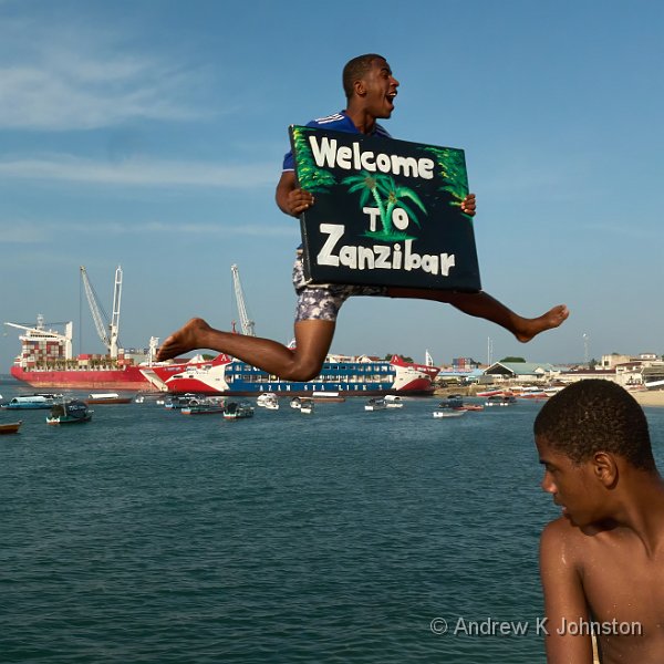
With my Zanzibar trip now firmly behind me, I’ve looked back and tried to condense what I experienced into guidance for future visitors and photographers.
This was my first trip to East Africa, and I came away with a lot of positive feelings. This appears to be a happy, vibrant place with lots of friendly people. Most of the practicalities worked fine, albeit sometimes a bit slowly, in a way familiar to anyone who has travelled in the tropics. I never felt the slightest issue in respect of personal security, and all my commercial transactions were honest and straightforward, although there was inevitably some haggling with shopkeepers to agree a price.
Photographic Subjects and Practices
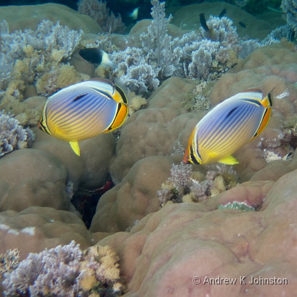
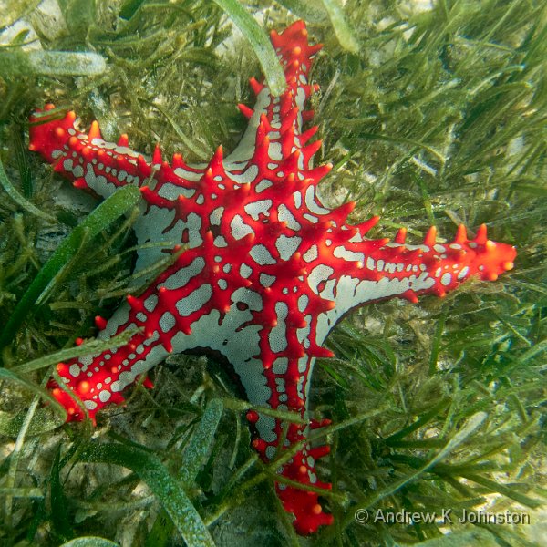
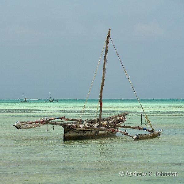
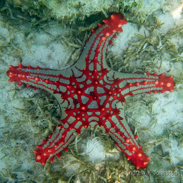
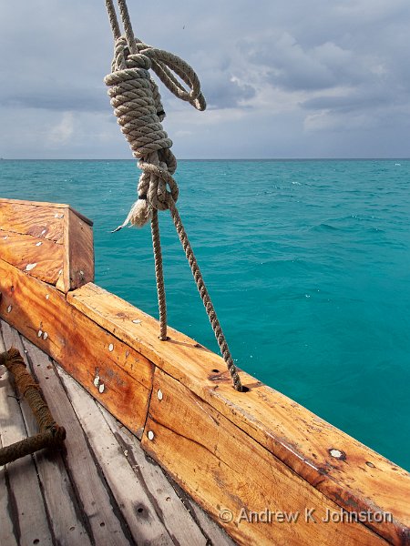
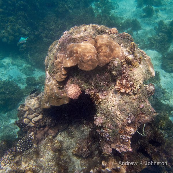
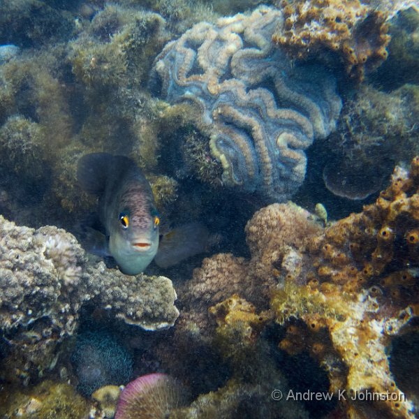
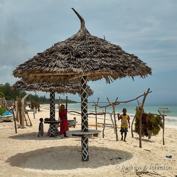
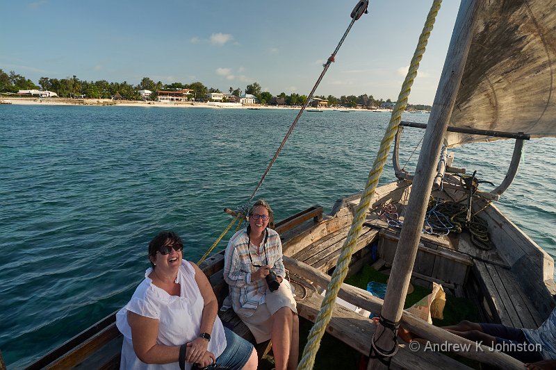
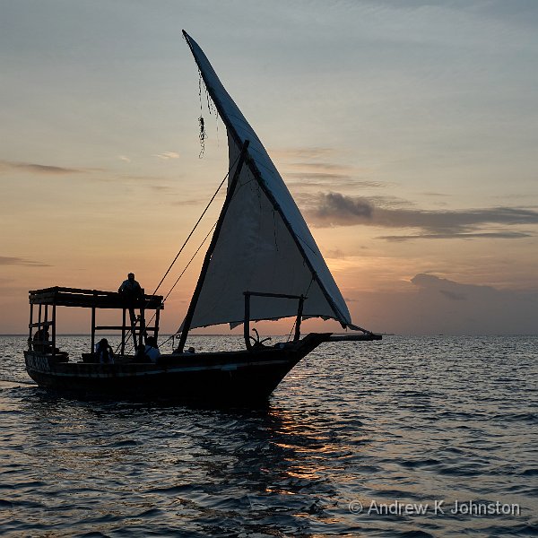
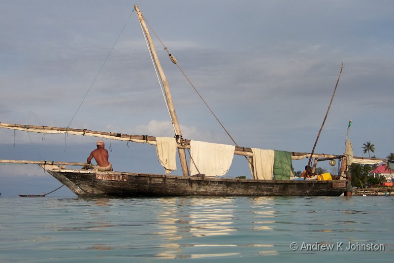
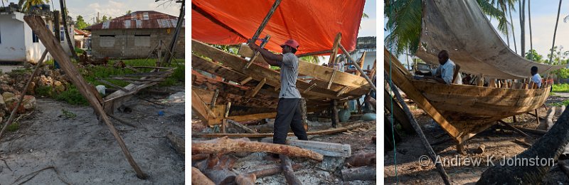
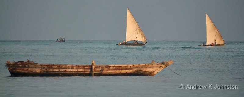
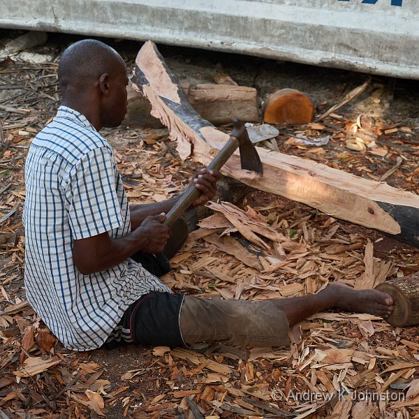
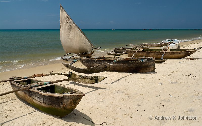
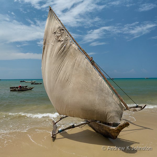
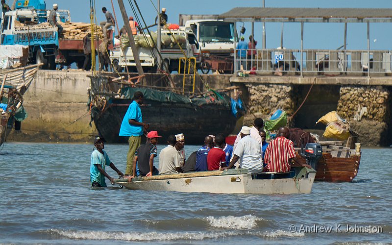
I did get some great shots of people, beaches and boats, and the snorkelling was easily the best I’ve done in about 20 years. For those happy in a relatively small boat I would thoroughly recommend a dhow trip, and a snorkelling trip with Safari Blue.
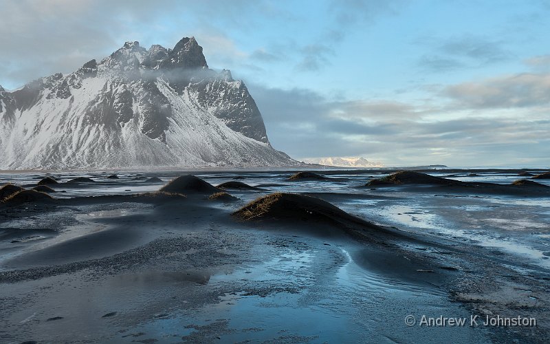
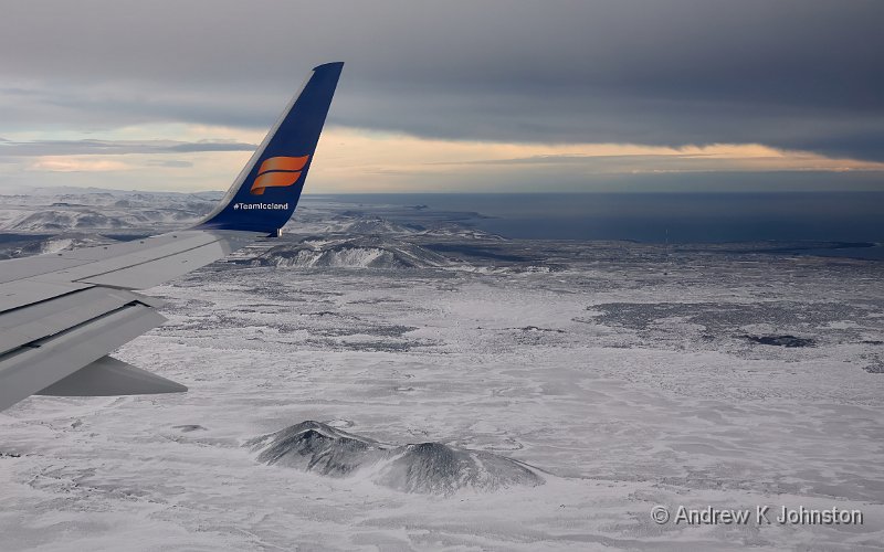
Beaches aside, there’s no scenery to speak of. The island is as flat as a pancake, covered with either very generic tropical vegetation or small-scale agriculture, broken intermittently by what are described as "villages" but many of which are in reality small towns of several thousand people. The historical area of Stonetown is home to some fascinating old narrow alleys and tall buildings, but away from there the vernacular architecture is either 1960s communist blocks, or nondescript smaller constructions of concrete blocks and corrugated iron. Both are, let’s be honest, just ugly. In some parts of the world buildings are at least cheered up by being painted in bright colours, but most in Zanzibar are left unpainted in drab greys and browns.
Stonetown does have a wonderful tradition of impressive, studded timber doors. These were present, but unfortunately at the time of our visit almost every one was covered in complex sets of numbers scrawled in chalk, the legacy of a recent census. Hopefully when the process is complete most will be cleaned and returned to their usual photogenic state, but I’ve come away with relatively few shots of these vaunted features.
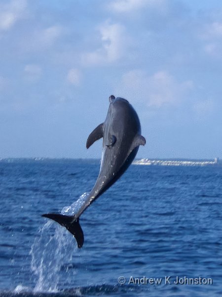
We didn’t see any wildlife except fish, a few birds, a couple of impressively large rats, and some amazingly colourful dragonflies which frequented the hotel pool but were impossible to photograph. An occasional rustle in the trees or roadside vegetation suggested some slightly larger fauna, but it didn’t make itself obvious.
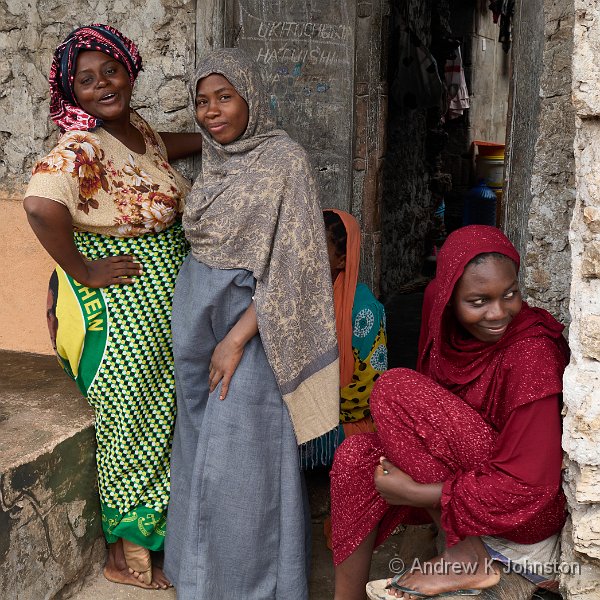
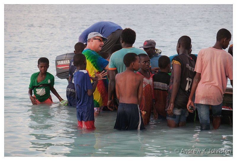
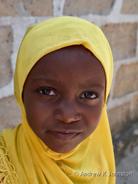
That brings us to the people. Most were pleasant and interesting, but not all were willing photographic subjects. They seemed to split down into a few groups (albeit with lots of borderline cases):
- Those who are happy to be photographed without immediate reward. A lot of people in direct tourist-facing roles are naturally in this group, however they are not the majority.
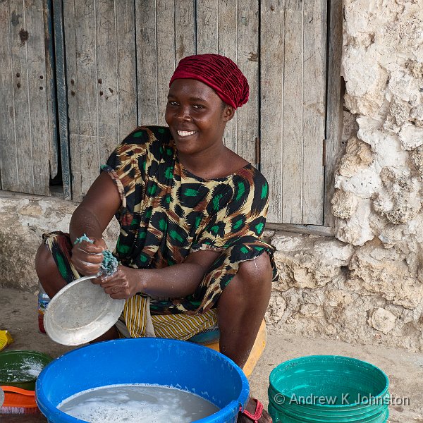
- Those who can be persuaded, especially if you engage with them first and take a genuine interest in their activity or situation, and then ask permission. This is down to your powers of persuasion, or those of your guide.
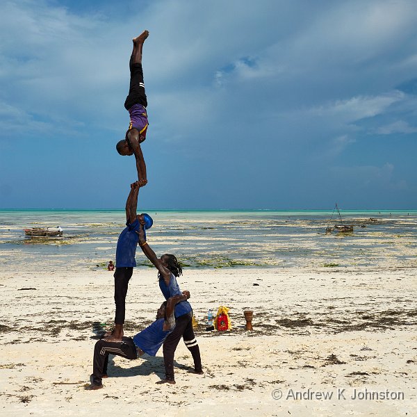
- Those who are happy to pose on the transactional basis that they will be paid. As well as entertainers working for tips you will find a number of the general public who operate on a "dollar for photo" or similar basis. Stallholders who have either just made a sale of who have a real prospect of one are also usually willing.
- Those who really don’t want to be photographed. I reckon this can be 50% or more in some cases. Some will make it very obvious with a "no photo" or covering their face. You have to acknowledge and honour this.
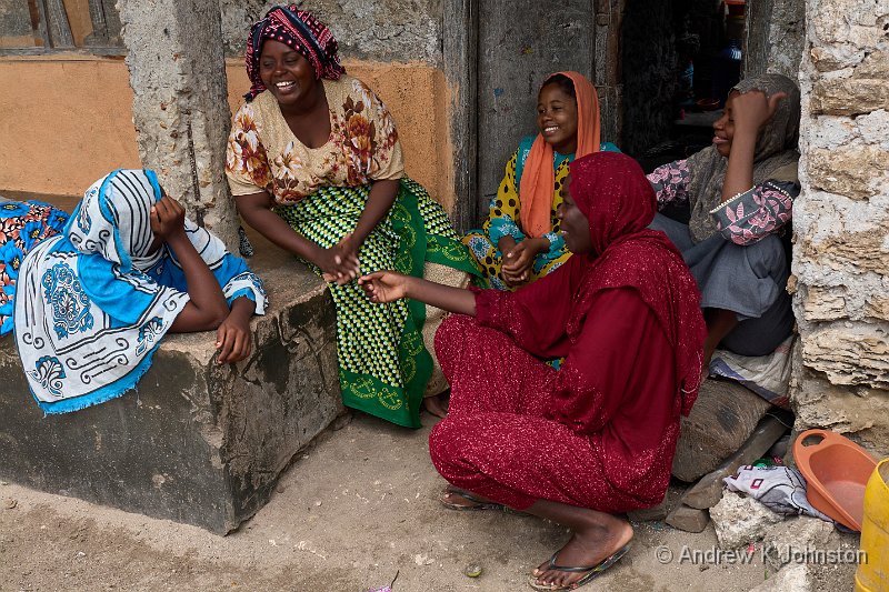
The reticence of many of the people seems to be down to a combination of the standard Muslim concern about images of people, more modern concerns about publishing one’s likeness, and an annoyance that their daily lives are being scrutinised by foreigners. It has to be said that most of us would be the same if the situation was reversed. I started to feel a bit uncomfortable tramping around the villages, and after a while focused photography on those in groups 1-3.
You also should be alert to those who due to peer pressure appear to be in group 2 or 3, but are actually in group 4. You may detect unease, or just poor poses and expressions – these are passive expressions of the same unwillingness. A good example is where we were invited into school classes, but some of the youngsters were obviously much less comfortable than others. Again, there’s no point in pushing with an unwilling subject.
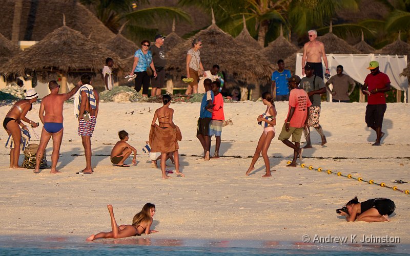
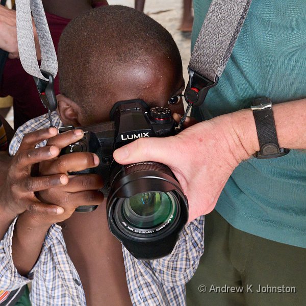
Finally you have to be aware of the psychological aspects of the photographic process on willing but inexperienced subjects. In a couple of cases we found a great model, but the first photographer in the group thrust an enormous camera and lens into her face and insisted on taking dozens of images, and the rest didn’t get a look in. That’s unfair on both the subject and the other photographers.
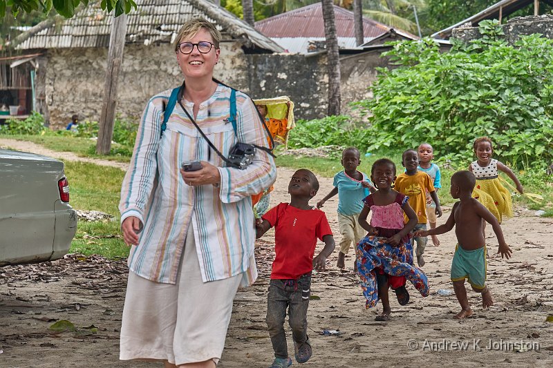
If you do have to pay a subject it won’t require much – 1 US dollar is a good reward for a some shots of an adult, and you can scale up to maybe $10 for a group. Carry lots of $1 notes. However it’s not a good idea to pay kids directly – this is clearly driving a lot of poor behaviours.
Photographic Kit
There’s not a great deal to say here. Any good camera should serve you well, and unless you’re going underwater the practical demands are limited. The beauty of Micro Four Thirds allowed me to take a range of lenses covering from ultra-wide angle to long telephoto without breaking the luggage limit, but the longer lenses got very limited use, and a standard pair of zooms covering the equivalent of 24-70mm and 70-200mm or similar would cover the vast majority of subjects.
My new Panasonic G9ii behaved faultlessly, and like its predecessor proved an ideal camera for travelling "light but fully equipped". I took 1662 images on it, about 110 on the Sony Rx100 mk 7, and about 316 using the waterproof Olympus TG6, across about 8 days of "active photography" (as opposed to lying by the pool). The count was lower than many trips, but reflected the limited need for multi-shot techniques or high frame rate action photography. About 50% of the shots have been retained for further processing after an initial edit, higher than usual for the same reasons.
Make sure you have a circular polariser for each lens. I just left mine on most of the time, as the light frequently demands it, and it’s good protection against the dust and moisture. Alternatively you might want to take clear or UV filters, but that’s arguably overkill. My ND filters didn’t come out of the bag, and I didn’t catch any of my companions messing about with square filters, ND Grads and the like – the subjects really didn’t call for it.
Underwater the TG6 worked well enough, and avoided the literally fatal failings of its predecessor. However the images are not that sharp, and battery life is very poor, as I found to my cost when I lost power halfway through the second snorkelling session. If you are doing a trip with multiple snorkel or dive sessions in the water, change the battery after each one, and accept the risk of opening the camera in a less controlled environment.
You could get away without taking a tripod. Mine never left the suitcase. Obviously it depends on your style, and your tolerance for higher ISO for evening shots, but I worked exclusively handheld. By and large it was too cloudy for genuine night photography, and otherwise the light levels and subjects were always workable.
If you are travelling to that part of the world with significant photographic kit, avoid Emirates as an airline. They have a ridiculous 7kg and one piece limit on cabin baggage which they enforce quite enthusiastically. My work-around was to wear a photographer’s vest which ended up almost as heavy as my bag, but I shouldn’t have to be forced to do so.
Otherwise that’s about it. The phrase which sums it up well is "f/8 and be there…"
Practicalities
This section does need a significant "your mileage may vary" warning – it reflects my experiences and others may be different. For example all the advice beforehand warned that insects might be a major issue, but I was sufficiently untroubled that by the end of the trip I wasn’t even putting repellent on, just making sure the mosquito net was secure overnight. However another member of the group did get a very nasty bite on the first night…
Zanzibar is well set up for tourism, and a lot of things "just worked". With one ultimately amusing exception, I didn’t experience any major hotel room malfunctions. Toilets were uniformly clean and functional. Transport arrangements were unproblematic.
Money is straightforward. Take lots of small US dollar bills for tips and small purchases – these are uniformly acceptable, the locals are well versed in applying a pragmatic exchange rate and rounding up or down as required, and it keeps your wallet simple. You can also get Tanzanian Shillings, or you might receive some in change, and that’s not a problem apart from the fact that the exchange rate is about 2500 to the $, or 3200 to the £, so you need to be careful with the number of zeroes! Larger bills will be presented in USD and can be settled with a credit card – just live with the small surcharge.
You will need a guide unless you’re just sticking to the environs of the hotels, and you will need a driver if you’re moving around. The main roads between towns and around Stonetown are very good and I’d be perfectly comfortable driving them, but get 10m off them and they are biblically bad. Both services are readily available at reasonable cost, so let them take the strain.
It is hot – in the 30s Celsius during the day, low 20s overnight, and humid, often without much of a breeze. Wear high factor sunscreen and be prepared to change your clothing fairly regularly. Be respectful with your clothing, but I didn’t find it necessary to follow the "cover up" guidance you get from some sources. A T shirt and shorts should be OK.
Try and adapt to the temperature. In your hotel room turn the air conditioning off, and the fan on. I slept like a log, but then I am used to the tropics and run a warm house at home. This is one of those YMMV bits.
One complaint we did have is that not enough water is served in hospitality settings. In most warm countries the first thing that happens in a restaurant or hotel is you get a glass of cold water, served from a freshly-opened bottle when required. Not in Zanzibar, you have to ask for water at meals, and you may have to manage your own supply in the hotel room. It’s not a problem – bottled water is readily available and inexpensive, but you do need to be alert to the issue and make sure you don’t accidentally get dehydrated.
Be absolutely religious about sticking to bottled water for drinking and tooth-cleaning. One of our party made a mistake on the latter and was then ill. I did try filling a kettle from the tap, but the cloudy fluid didn’t look like even boiling it would necessarily remove everything untoward, and I switched back to bottled water even for tea.
We all suffered from some measure of "tummy trouble", some, as in my case, fairly minor, some less so. My suspicion fell on the attractive salads and ice cream served by the Z Hotel, and I switched to the "bottle and burger"™ diet. This is very simple: don’t drink anything you didn’t see come out of a bottle – water, wine, beer and spirits are fine, but no cocktails. Don’t eat anything which hasn’t been baked, grilled or fried immediately before serving. Hot drinks are OK, as are boiled vegetables but only if they are still steaming – cold rice and similar are a no-no. It worked for me.
After the trip we did share our concerns about the salads with the hotel manager who assured us that all vegetables were washed using boiled water. As they say in the British Parliament, "I refer the gentleman to my earlier statement."
I mentioned that in most respect most of the hotel rooms worked quite well. However we did get one new entry for the dysfunctional hotels blog. In my first room at the Emerson Hotel in Stonetown the active and spare toilet rolls were strung on a rope from the ceiling, conveniently positioned for when required. In principle this is a good design, however in a tropical downpour on the first night water got in from outside, ran down the rope, and soaked both rolls. Annoying, especially as this is not an obvious failure until your need is unavoidable!
Service and Sophistication
Service was always willing and helpful, but occasionally annoying despite the good intentions. Paying or signing for drinks at the hotels is a good example. The staff don’t want to bother you while, or immediately after, consuming your drink. That’s great, but it can turn into either an interminable wait when you’re ready to go, or to your being pursued around the hotel with an unsigned chitty at shift end. Being proactive doesn’t necessarily help: I got a great cup of coffee early one morning, but while the barman could work the coffee machine to good effect, neither he nor any of the other staff on duty could work the till. I had to come back later.
More complex services are a mixed bunch. I had absolutely outstanding service from Safari Blue who not only provided a snorkelling trip but also arranged my travel, meals and changing facilities for my final day.
On the other hand I was also hoping to get two additional side-trips into the last few days: a deep sea fishing trip, and a catamaran cruise. I have done each many times in the Caribbean, you just ring up, book your place, turn up and pay. Often they even provide a taxi from your hotel. Not in Zanzibar. You can’t walk 100 yards down the beach without someone pestering you about a fishing trip, but it’s a completely different commercial model. They will happily charter you a boat, for anywhere between $400 and $1000, but it’s then your job to fill it. There’s no such thing as a "shared" trip where they do that work, apart from the dhow cruises. I couldn’t interest my companions, so the week came and went without fishing or a catamaran trip.
It’s apparent that the challenges in the educational system are failing many Zanzibarians. The inability to work the till was one example, but in fairness that was obviously a "training" hotel. However I found quite a few examples of limited reasoning skills or "learned stupidity". For example, The Z Hotel will make you a nice latte and serve it in a tall glass as per custom. So far so good. They have two sizes of saucers in their crockery set: a larger one with a dimple the right size for the latte glasses, and a smaller one where the dimple is too small and the glass wobbles alarmingly on top. You can guess which one they had all been told to use, and no amount of demonstrating the issue to the waiters every day for a week made a blind bit of difference.
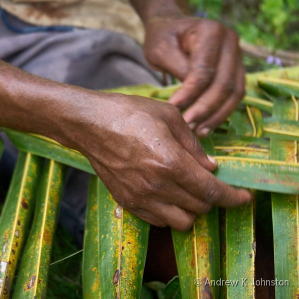
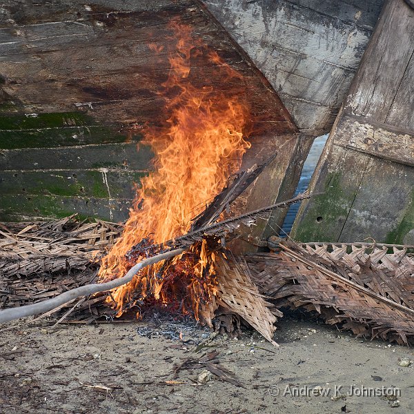
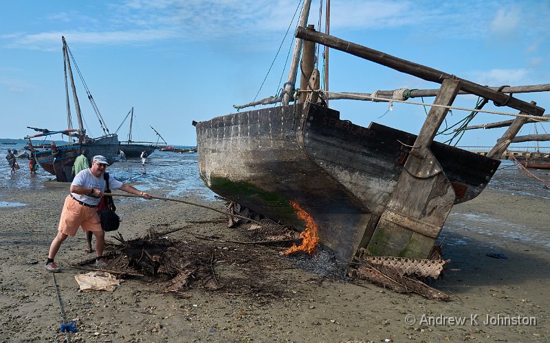
Compared with some other tropical locations, there does seem to be a genuine intention to try and reduce the environmental impact of both general living and tourism. Waste was minimised and well-managed, with impressive recycling or reduction of most plastics. I even saw an old lady recycling nylon rope, using exactly the same method as others use with coconut fibres. That said there are some messy corners in villages, and on some non-tourist beaches, but you feel that they are trying to do the right thing.
And Finally…
There’s a Swahili phrase which gets a lot of use: "Pole Pole" (pronounced pole-ay, literally "slowly, slowly"). Sometimes this is meant as "go carefully", for example when getting on or off a boat. But it’s also an excuse, like "island time" or "maņana". If you’ve travelled in the tropics before the relaxed timekeeping and unhurried approach will be nothing new. If you haven’t, then sit back and relax – there’s not much you can do about it!

 List
List Abstract
 One+Abstract


 Email me
 Others
 Main feed (direct XML)