| Sunrise from Yavapai Point, Grand Canyon | |
| Camera: Panasonic DC-G9 | Date: 04-10-2023 07:33 | Resolution: 5176 x 2915 | ISO: 200 | Exp. bias: -33/100 EV | Exp. Time: 1/200s | Aperture: 5.6 | Focal Length: 35.0mm | Location: Yavapai Point | State/Province: Grand Canyon, Coconino, Arizona | See map | Lens: LUMIX G VARIO 12-35/F2.8II | |
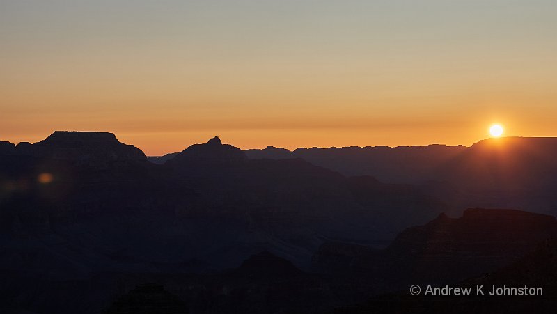
I started the day in Grand Canyon with a third sunrise shoot, this time at Yavapai Point. I was almost first there and could choose my spot, but it soon got very busy. What was interesting was that in the dark we could see a long line of head-lights descending below Yaki point, so that explained the empty bus the day before. The sky was much clearer making for a different experience and a good farewell to the Canyon.
| Sunrise from Yavapai Point, Grand Canyon (Show Details) |
In an ideal world we would have visited Bryce Canyon much earlier in the trip, but we simply couldn’t get accommodation, so we had to loop back after Grand Canyon. This added a 300 mile drive, but the roads are good and Cameron, Page and Kanab are almost exactly at the 75 mile points.
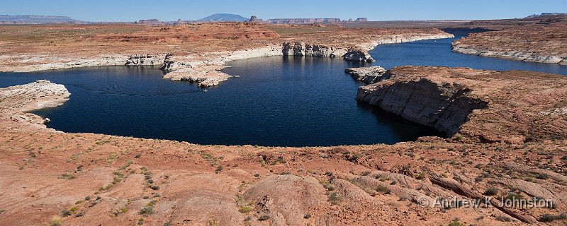
Page has changed almost beyond recognition since our last visit. It’s much larger, with the section we recognised just a corner of the new town. The scariest part was "church row", with well over 20 religious meeting houses of all denominations one after the other.
Everything is on a much larger scale. When we visited Horseshoe Bend in 2007 it consisted of a few gravel parking spaces off the side of the road, and a path up to the viewpoint. Now it has a massive visitor centre and car park and people actually run organised tours from the town.
The other scary thing was the height of the water in Lake Powell, or more accurately the lack thereof. Apparently this year they have been within a few feet of having to stop generating power at the dam. Let’s hope for a wet winter.
| Lake Powell (Show Details) |
On the Trail
We had a somewhat interrupted night’s sleep. The new hotel at Bryce Canyon is well appointed with large rooms, but half face inward to a common courtyard and pool area, so if anyone has a noisy air conditioner or even fridge you all hear it.
As a result we got up slowly and almost missed breakfast, but the staff took pity and served us just before they cleared away.
We planned to drive into the park, to the end of the Scenic Drive, and then work back viewpoint by viewpoint. Unfortunately Frances took a tumble on a rough bit of one of the trails, and we had to retire back to confirm no major harm done.
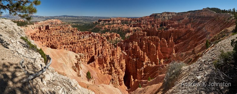
In the afternoon I went up to Inspiration Point and hiked down to Sunset Point, and then did part of the Navajo Trail to photograph Thor’s Hammer, in great light. I decided to try and get the bus back to the Inspiration Point car park, to discover that the Bryce Canyon shuttle system is considerably more arcane than those in either Zion or the Grand Canyon. The most puzzling element is that the maps and timetables use the name "Sunset" for both Sunset Point and Sunset Camp, which are in different places about 1/4 mile apart on different bus routes. Fortunately I found a helpful ranger, otherwise I might still be there.
| Silent City, Bryce Canyon (Show Details) |
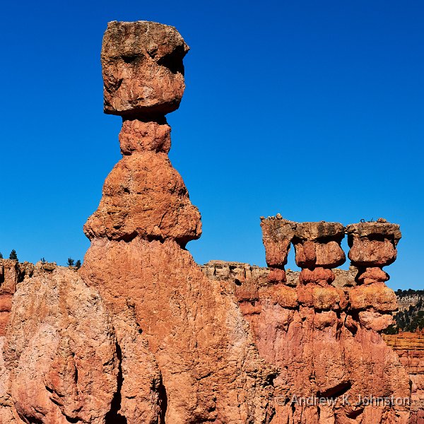
| Thor’s Hammer (Show Details) |
In the evening we drove a few miles to the puzzlingly-named town of Tropic and had dinner at the Stonehearth Grille. Getting there is a bit disconcerting as it feels you’re driving miles into the middle of nowhere, but it’s worth the trip. It’s a bit lacking in ambiance, but has excellent food and service, and great views of the sun setting on the Bryce Cliffs.


 Email me
 Others
 Main feed (direct XML)