| Grosvenor Arch | |
| Camera: Panasonic DC-G9 | Date: 26-09-2023 14:58 | Resolution: 5100 x 3188 | ISO: 200 | Exp. bias: -33/100 EV | Exp. Time: 1/500s | Aperture: 7.1 | Focal Length: 26.0mm | Location: Grosvenor Arch | State/Province: Henrieville, Garfield, Utah | See map | Lens: LUMIX G VARIO 12-35/F2.8II | |
After breakfast we set off for the drive back to Kanab. We shared the first two stages, over the mountain to Boulder and then down the SR12 to Cannonville. These were uneventful, except to note that the aspen trees which were green four days earlier were now almost all yellow, and a few were on the way to orange. It’s amazing how a few cold nights can bring on such a sudden and coordinated change.
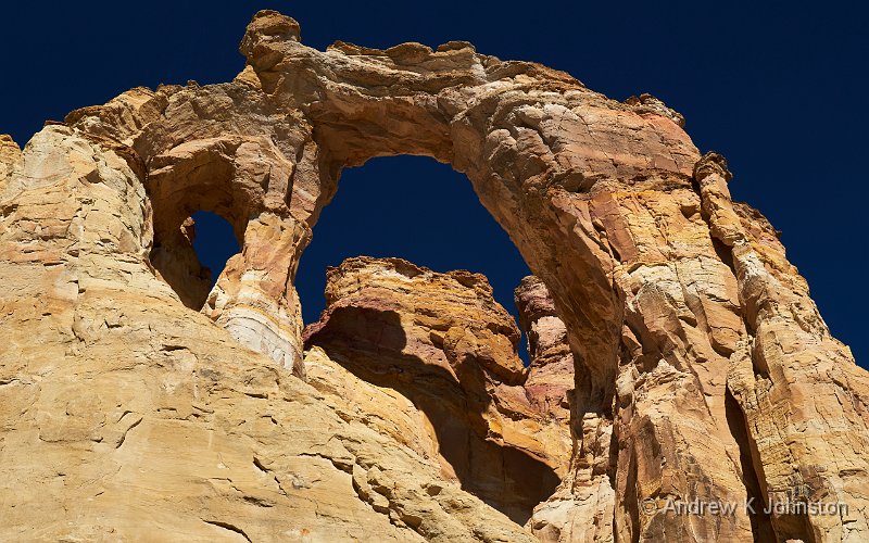
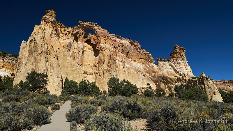
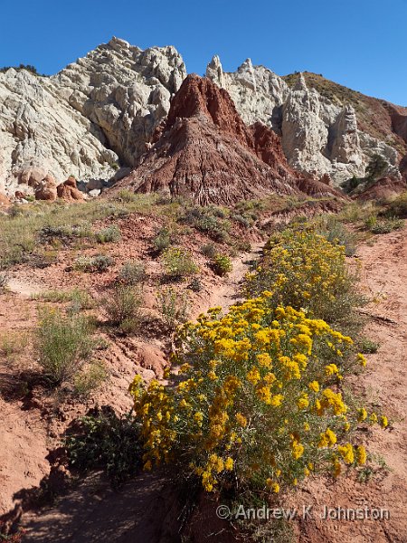
At Cannonville we left the main road and set off down Cottonwood Canyon Road – a well maintained but unsurfaced road which cuts straight through the Paria Plateau to emerge halfway between Page and Kanab. Completing this road had been on my to-do list since originally planning the 2007 trip. It’s a dramatic road of constantly changing scenery and geology. However the highlight for me was definitely Grosvenor Arch, a dramatic bluff of yellow stone in the middle of nowhere, topped by an amazing arch structure. The Jag-war, with its Range Rover underpinnings, managed the drive without fault, but I certainly wouldn’t attempt it in something with two wheel drive.
| Grosvenor Arch, traditional view (Show Details) |
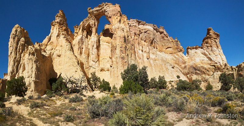
| Grosvenor Arch, side view (Show Details) |
The last few miles of the road are a bit boring and feel somewhat interminable, but we eventually emerged onto highway 89 and turned right for Kanab. The town is very spread out, with a road pattern which while it does follow the American grid system, seems to have somewhat arcane numbering, and as a result we couldn’t find our hotel. At one point we pulled in in front of the local school, and I attempted to work out what we should be doing. Unfortunately the downloaded maps on Gaia GPS, while they appear to map almost every rock in Utah, don’t have Kanab street names so that wasn’t much help.
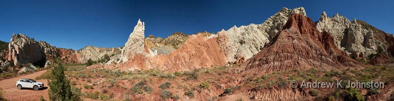
| Candyland, Cottonwood Canyon Road (Show Details) |
Meanwhile Frances was sitting pointing at the big screen on the car’s dashboard, struggling for the right words. "That.. The magic machine… For Finding Places… Would that work?". After much hilarity we put the address into the Jag’s GPS and it took us directly to the hotel. Magic.
Dinner was somewhat delayed for various reasons. We were running late and most restaurants in Kanab had a queue. We got near to the front at one before realising that the primary ingredients in all their dishes were garlic and chilli. We were finally sat down with drinks and food ordered at the Iron Horse, and all the lights went out! The staff appeared completely unphased and just circulated with warm words until things went back on about 15 mins later. We were eventually fed and watered, but somewhat later than planned.
| Candyland, Cottonwood Canyon Road (Show Details) |


 Email me
 Others
 Main feed (direct XML)